THE WANDERING
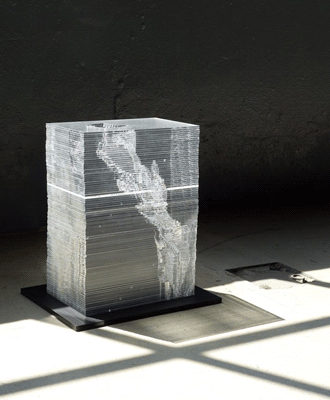
A HALF METER PER DAY
At a speed of a half meter per day the brown coal mining hole Garzweiler II ‘wanders’ through the landscape of Germany.
The object shows the migration : each layer represents one year ( 1955 – 2045 ).
→ Read and see more …

MAP OF GARZWEILER
ONE OF THE THE LARGEST MAN-MADE HOLES IN THE WORLD
The map shows current stae of affair ( June 2015) and the white lines display the infrastructure before the wandering of the brown coal mining hole 'Garzweiler II'.
→ Read and see more …
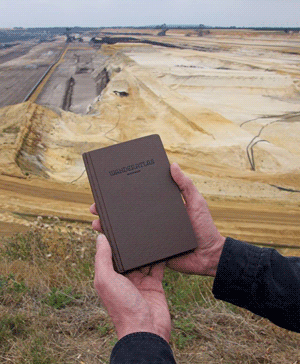
THE ATLAS
OF THE IN-BETWEEN
The wanderatlas shows 2 routes through
the mining district 'Garzweiler', based on the current state of affairs ( June 2015 ).
→ Read and see more …